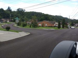
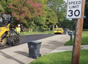
The City’s $7.4 million 2020 Resurfacing Project is almost wrapped up for the year, repaving 37.5 miles of streets as well as about 50 speed humps for Neighborhood Traffic Safety traffic-calming projects in six neighborhoods.
Did you know that the City each year paves roughly the same number of miles of streets in each City Council district? Or that major traffic arteries get fresh asphalt every 10 years?
Parity – equal miles resurfaced in each part of the City – is mandated in the City Code. Another round of repavings will start up again with warm weather in 2021.
Here are some of the larger street repavings this year, broken down by City Council district:
1st District
- Mountain Grove Drive, between Gov. John Sevier and Chapman highways (12,617 square yards of asphalt)
- South Haven Road, two sections, each off of Sevierville Pike (12,493 square yards)
- East Red Bud Road, between Panorama Drive and Chapman Highway (12,278 square yards)
- Price Avenue, between Cottrell Street and Gilbert Lane (10,883 square yards)
- Spence Place, between Maplewood Drive and a bridge (9,244 square yards)
2nd District
- Corteland Drive, between Broome Road and Sheffield Drive (22,155 square yards)
- Crystal Lake Drive, between Whitower Drive and Duncan Road (14,112 square yards)
- Homberg Drive, between Whittaker Drive and Kingston Pike (6,169 square yards)
- Cherokee Boulevard, between Chickasaw Road and Lakeland Drive (5,322 square yards)
- Turkey Drive, between Wild Geese and Snow Goose roads (5,116 square yards)
3rd District
- Trousdale Road, between Hunters Glen and Ellesmere drives (10,134 square yards)
- John May Drive, between Woods-Smith Road and Ball Camp Pike (8,347 square yards)
- Hunters Glen Drive, between West End and East End (5,538 square yards)
- Goldenrod Circle, between Western Avenue and Ball Camp Pike (4,796 square yards)
- Elm View Drive, between Sullivan Road and Chestnut View Drive (4,073 square yards)
4th District
- Shangri-La Drive, between Wayne Drive and Ault Road (11,004 square yards)
- Fenwood Drive, between Montross Road and East End (8,304 square yards)
- Larigo Drive, between Shangri-La and Valdena Drive (7,650 square yards)
- Larigo Drive, between Veldena and Del Mabry Drive (7,650 square yards)
- Nottingham Road, between Ridgecrest and Westchester drives (7,085 square yards)
5th District
- McClain Drive, between Capri Drive and Clinton Highway (8,287 square yards)
- Wallwood Road, between Clinton Highway and Victor Drive (5,280 square yards)
- Haynes-Sterchi Road, between Martha Lane and Ozark Road (5,088 square yards)
- Scenicwood Road, between Merchant Drive and Scenichills Road (3,823 square yards)
- Farris Drive, between Clinton Highway and Tillery Road (3,642 square yards)
6th District
- Woodbine Avenue, between Mitchell Street and East End (29,434 square yards)
- Howard Baker Jr. Avenue, between Hall of Fame Drive and East Hill Avenue (12,943 square yards)
- Moses Avenue, between James Davis Drive and Boyd Street (7,211 square yards)
- Riverview Drive, between McDonald Drive and Holston Hills Drive (6,851 square yards)
- Proctor Street, between Western Avenue and Middlebrook Pike (6,418 square yards)
For more details on the 2020 Resurfacing Project, including an alphabetized listing of all streets throughout the city being upgraded, visit here.


